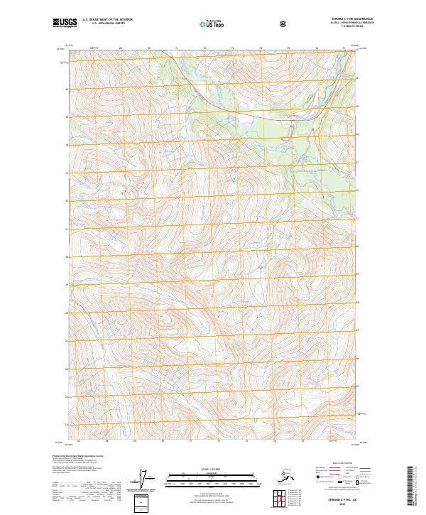
2023 Map of Seward C-7 NE
USGS Topo · Published 2023About this map
The Chugach National Forest provides the setting for this detailed survey of the Kenai Peninsula interior. The landscape is defined by a dense network of drainages, including East Fork Sixmile Creek, Silvertip Creek, and Juneau Creek, which carve through the high elevations of the surrounding mountains. Human presence is concentrated along the Seward Highway corridor, which serves as the primary artery for travel through these forest lands. Historically significant routes are also represented, notably a section of the Iditarod National Historic Trl as it winds near Bench Creek and Center Creek. This modern survey highlights the continued importance of recreation and heritage in the region, featuring the Granite Creek Campground Rd and several named creeks like Spokane Creek and Roaring Creek that have long drawn explorers and outdoorsmen to this part of Alaska.
Find a feature on this map
29 named features on this map. Tap any name to fly to it.
Don’t see what you’re looking for? This feature index may not catch every label — zoom into the map to look around manually.
Map Details
Editions of this 2023 Seward C-7 NE Map
This is the sole edition of this map. No revisions or reprints were ever made.
Other maps of this area

1951 · Seward
USGS Topo · 1:250,000

1951 · Seward C-6
USGS Topo · 1:63,360

1951 · Seward D-7
USGS Topo · 1:63,360

1951 · Seward C-7
USGS Topo · 1:63,360

1951 · Seward D-6
USGS Topo · 1:63,360

1952 · Seward C-6
USGS Topo · 1:63,360

1952 · Seward D-6
USGS Topo · 1:63,360

1952 · Seward D-7
USGS Topo · 1:63,360

1953 · Seward C-7
USGS Topo · 1:63,360

1953 · Seward
USGS Topo · 1:250,000