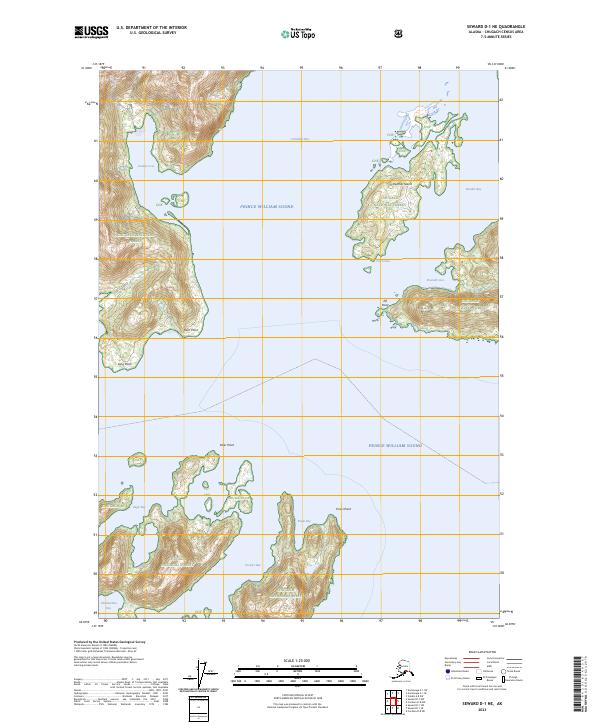
2023 Map of Seward D-1 NE
USGS Topo · Published 2023About this map
Prince William Sound dominates this coastal survey, where the glacial waters meet the complex shoreline of the Chugach National Forest. The map documents a landscape defined by deep-water inlets and numerous named points, including Flent Point and Long Point along the western coast, and the prominent Elder Point to the south. Central to the maritime geography are several substantial islands and bays, most notably Heather Island tucked between Columbia Bay and Heather Bay. This modern topographic study illustrates the intricate bathymetry of the Alaskan coast, highlighting natural passages such as Lutris Pass and protected anchorages like Granite Cove and Emerald Cove. The terrain rises sharply from the sea to landmarks like Round Mtn, reflecting the characteristic coastal elevation changes found within the Chugach NF boundaries.
Find a feature on this map
24 named features on this map. Tap any name to fly to it.
Don’t see what you’re looking for? This feature index may not catch every label — zoom into the map to look around manually.
Map Details
Editions of this 2023 Seward D-1 NE Map
This is the sole edition of this map. No revisions or reprints were ever made.
Other maps of this area

1948 · Cordova
USGS Topo · 1:250,000

1951 · Seward
USGS Topo · 1:250,000

1951 · Anchorage
USGS Topo · 1:250,000

1951 · Cordova
USGS Topo · 1:250,000

1951 · Seward D-1
USGS Topo · 1:63,360

1951 · Cordova D-8
USGS Topo · 1:63,360

1952 · Valdez
USGS Topo · 1:250,000

1952 · Seward D-1
USGS Topo · 1:63,360

1952 · Cordova D-8
USGS Topo · 1:63,360

1953 · Seward
USGS Topo · 1:250,000