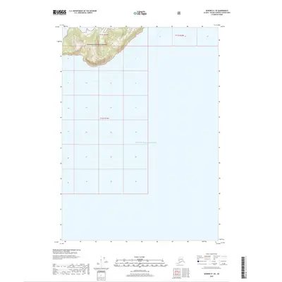
2018 Map of Seward D-1 SE
USGS Topo · Published 2018About this map
The waters of Prince William Sound dominate this coastal survey, where the maritime environment meets the southern edge of the Chugach National Forest. The map is characterized by a prominent landmass in the northwest corner, terminating at the shoreline feature known as Bull Head. This topographical interface reveals a steep landscape defined by elevation contours that rise sharply from the sound into the protected forest lands. Aside from the primary coastal boundary and the named headland, the area remains largely undeveloped and focused on the natural transition between the protected forest and the open water of the sound. The absence of roads or established settlements emphasizes the remote, wilderness character of this portion of the Alaska-Valdez-Cordova Census Area.
Find a feature on this map
6 named features on this map. Tap any name to fly to it.
Don’t see what you’re looking for? This feature index may not catch every label — zoom into the map to look around manually.
Map Details
Editions of this 2018 Seward D-1 SE Map
This is the sole edition of this map. No revisions or reprints were ever made.
Other maps of this area

1948 · Cordova
USGS Topo · 1:250,000

1950 · Cordova C-8
USGS Topo · 1:63,360

1951 · Seward
USGS Topo · 1:250,000

1951 · Cordova
USGS Topo · 1:250,000

1951 · Seward D-1
USGS Topo · 1:63,360

1951 · Cordova D-8
USGS Topo · 1:63,360

1951 · Seward C-1
USGS Topo · 1:63,360

1952 · Seward C-1
USGS Topo · 1:63,360

1952 · Seward D-1
USGS Topo · 1:63,360

1952 · Cordova D-8
USGS Topo · 1:63,360