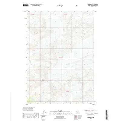
2017 Map of Seward D-5 NE
USGS Topo · Published 2017About this map
Chugach National Forest encompasses this section of the Chugach Mountains north of Seward, Alaska, where a massive network of ice fields and flowing glaciers dominates the high-elevation landscape. The terrain is defined by several major glacial systems, including the Surprise Glacier and Lake George Glacier in the northern reaches, and the Harriman Glacier which flows through the center. This 2017 survey illustrates the complex relationship between these ice bodies and the nascent river systems they feed, such as the Upper Carmen River and Twentymile Glacier drainage. The map reveals the intricate contouring of a frozen wilderness, showcasing how the Billings Glacier, Pigot Glacier, and Seth Glacier carve through the mountain passes, offering a precise view of the topography before significant seasonal or climatic shifts alter these ancient ice flows.
Find a feature on this map
10 named features on this map. Tap any name to fly to it.
Don’t see what you’re looking for? This feature index may not catch every label — zoom into the map to look around manually.
Map Details
Editions of this 2017 Seward D-5 NE Map
This is the sole edition of this map. No revisions or reprints were ever made.
Other maps of this area

1951 · Seward
USGS Topo · 1:250,000

1951 · Anchorage
USGS Topo · 1:250,000

1951 · Seward D-5
USGS Topo · 1:63,360

1951 · Seward D-4
USGS Topo · 1:63,360

1952 · Seward D-5
USGS Topo · 1:63,360

1952 · Seward D-4
USGS Topo · 1:63,360

1953 · Seward
USGS Topo · 1:250,000

1959 · Seward
USGS Topo · 1:250,000

1960 · Anchorage A-5
USGS Topo · 1:63,360

1960 · Anchorage A-4
USGS Topo · 1:63,360