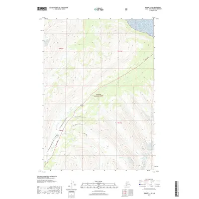
2018 Map of Seward D-6 SW
USGS Topo · Published 2018About this map
Turnagain Pass serves as the central focal point of this mountain landscape within the Chugach National Forest on the Kenai Peninsula. The terrain is defined by steep ridges and glacial valleys, drained by waterways such as Seattle Cr, Ingram Cr, and Granite Cr. The Seward Highway provides the primary corridor through the pass, facilitating access to a network of winter recreation routes. Modern land use is evident in the detailed mapping of the Tincan Mountain Ski Trail (Snow) and the INHT: Turnagain Pass Snowmachi (Snow), highlighting the area's importance for backcountry transit. High peaks like Kickstep Mtn loom over the drainage basins, while smaller features like Lyon Ponds and the Center Ridge Trail offer localized points of interest for those studying the recreational geography of the region.
Find a feature on this map
23 named features on this map. Tap any name to fly to it.
Don’t see what you’re looking for? This feature index may not catch every label — zoom into the map to look around manually.
Map Details
Editions of this 2018 Seward D-6 SW Map
This is the sole edition of this map. No revisions or reprints were ever made.
Other maps of this area

1951 · Seward
USGS Topo · 1:250,000

1951 · Seward C-6
USGS Topo · 1:63,360

1951 · Seward D-7
USGS Topo · 1:63,360

1951 · Seward C-7
USGS Topo · 1:63,360

1951 · Seward D-6
USGS Topo · 1:63,360

1952 · Seward C-6
USGS Topo · 1:63,360

1952 · Seward D-6
USGS Topo · 1:63,360

1952 · Seward D-7
USGS Topo · 1:63,360

1953 · Seward C-7
USGS Topo · 1:63,360

1953 · Seward
USGS Topo · 1:250,000