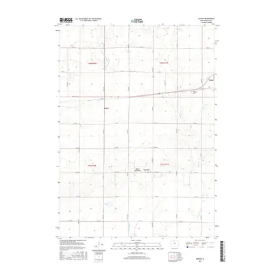
2015 Map of Sexton
USGS Topo · Published 2015About this map
The agrarian landscape of Kossuth County unfolds across this modern topographic survey, centered on the settlement of Sexton. The region is defined by an extensive network of water management, evidenced by features such as Drainage Ditch Number 84 and Drainage Ditch Number 177, which support the intensive cultivation of the surrounding Iowa prairie. To the northeast, the town of Wesley sits along the corridor of Old Hwy 18, while the village of Saint Benedict provides a southern anchor for the community. Genealogy and local history are preserved at sites like the Wesley Evergreen Cem and the Saint Benedict Catholic Cem. The map illustrates a disciplined grid of section roads, including 240th St and 170th St, which serve as the primary arteries for this rural district. Numerous small watercourses, such as Prairie Cr and Eddy Cr, weave through the township boundaries of t96n r27w and t95n r28w.
Find a feature on this map
22 named features on this map. Tap any name to fly to it.
Don’t see what you’re looking for? This feature index may not catch every label — zoom into the map to look around manually.
Map Details
Editions of this 2015 Sexton Map
This is the sole edition of this map. No revisions or reprints were ever made.
Other maps of this area

1954 · Fairmont
USGS Topo · 1:250,000

1954 · Mason City
USGS Topo · 1:250,000

1954 · Waterloo
USGS Topo · 1:250,000

1954 · Fort Dodge
USGS Topo · 1:250,000

1955 · Waterloo
USGS Topo · 1:250,000

1957 · Fort Dodge
USGS Topo · 1:250,000

1957 · Mason City
USGS Topo · 1:250,000

1958 · Mason City
USGS Topo · 1:250,000

1958 · Fort Dodge
USGS Topo · 1:250,000

1958 · Fairmont
USGS Topo · 1:250,000