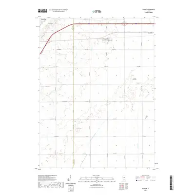
2021 Map of Seymour
USGS Topo · Published 2021About this map
Seymour and Bondville anchor this contemporary look at the central Illinois prairie, where the rural grid meets the edge of expanding regional connectivity. The landscape is defined by its agricultural heritage and hydraulic engineering, evidenced by the Kankakee Drainage Ditch and the winding course of Camp Cr. Notable landmarks such as the Saint Boniface Cem and the rise of Blue Mound provide points of interest for genealogists and local historians tracing long-standing land divisions. The area maintains its small-town character while supporting specialized infrastructure like the Litchfield RLA Airport. This survey captures the transition between the small settlements of Centerville and the larger corridors that link these communities across the Piatt and Champaign County line.
Find a feature on this map
34 named features on this map. Tap any name to fly to it.
Don’t see what you’re looking for? This feature index may not catch every label — zoom into the map to look around manually.
Map Details
Editions of this 2021 Seymour Map
This is the sole edition of this map. No revisions or reprints were ever made.
Other maps of this area

1907 · Mahomet
USGS Topo · 1:62,500

1937 · Monticello
USGS Topo · 1:48,000

1943 · Monticello
USGS Topo · 1:62,500

1950 · Tuscola
USGS Topo · 1:62,500

1955 · Bement
USGS Topo · 1:62,500

1957 · Rising
USGS Topo · 1:24,000

1957 · Mahomet
USGS Topo · 1:62,500

1957 · Bondville
USGS Topo · 1:24,000

1958 · Peoria
USGS Topo · 1:250,000

1958 · Decatur
USGS Topo · 1:250,000