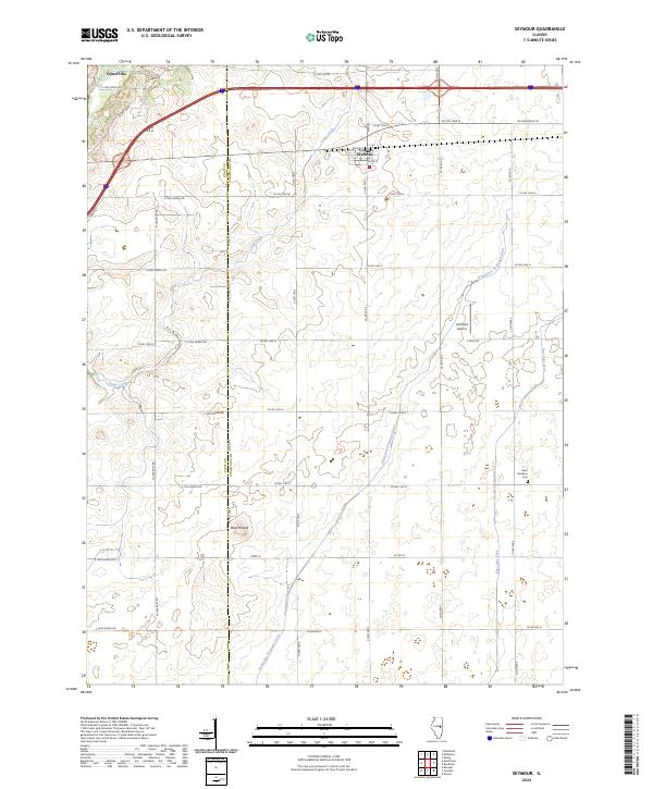
2024 Map of Seymour
USGS Topo · Published 2024About this map
Seymour and Centerville anchor the upper reaches of this agricultural landscape along the Piatt Co Champaign Co line. The terrain is defined by engineered water management and natural drainage, where the winding path of Camp Creek contrasts with the straight-line efficiency of the Kankakee Drainage Ditch. This 2024 survey captures a rural Illinois corridor where section-line roads like E 1800 North Rd and Co Rd 100 E create a rigid grid across the prairie.
Find a feature on this map
42 named features on this map. Tap any name to fly to it.
Don’t see what you’re looking for? This feature index may not catch every label — zoom into the map to look around manually.
Map Details
Editions of this 2024 Seymour Map
This is the sole edition of this map. No revisions or reprints were ever made.
Other maps of this area

1907 · Mahomet
USGS Topo · 1:62,500

1937 · Monticello
USGS Topo · 1:48,000

1943 · Monticello
USGS Topo · 1:62,500

1950 · Tuscola
USGS Topo · 1:62,500

1955 · Bement
USGS Topo · 1:62,500

1957 · Rising
USGS Topo · 1:24,000

1957 · Mahomet
USGS Topo · 1:62,500

1957 · Bondville
USGS Topo · 1:24,000

1958 · Peoria
USGS Topo · 1:250,000

1958 · Decatur
USGS Topo · 1:250,000