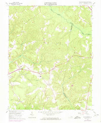
1965 Map of Shacklefords
USGS Topo · Published 1974About this map
The Poropotank River and the meandering Dragon Swamp define the boundaries of King and Queen and Gloucester counties, framing a landscape characterized by low-lying wetlands and scattered upland hamlets. In the mid-1960s, this rural interior centered on Shacklefords, where the road network converges at Shacklefords Fork. The map records a deeply rooted social geography, anchored by numerous country churches such as Poroporone Ch, Escoe Brook Ch, and Union Prospect Ch. Educational and community life is marked by the presence of York Academy near Cologne, while the area around Hockley preserves local genealogy through sites like Hockley Cem. The reliance on local resources is evident in the naming of Burnt Mill Creek and Glebe Swamp, alongside several active Sandpit locations that suggest the small-scale industry of the era.
Find a feature on this map
27 named features on this map. Tap any name to fly to it.
Don’t see what you’re looking for? This feature index may not catch every label — zoom into the map to look around manually.
Map Details
Editions of this 1965 Shacklefords Map
4 editions found
Other maps of this area

1906 · Williamsburg
USGS Topo · 1:62,500

1917 · Urbanna
USGS Topo · 1:62,500

1917 · Toano
USGS Topo · 1:62,500

1918 · Toano
USGS Topo · 1:62,500

1919 · New Kent
USGS Topo · 1:62,500

1943 · Richmond
USGS Topo · 1:250,000
1946 · Urbanna
USGS Topo · 1:24,000
1949 · Truhart
USGS Topo · 1:24,000
1949 · Saluda
USGS Topo · 1:24,000

1949 · Shacklefords
USGS Topo · 1:24,000