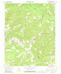
1965 Map of Shacklefords
USGS Topo · Published 1980About this map
Dragon Swamp and the Poropotank River define the intricate drainage patterns of this Tidewater landscape at the junction of King and Queen, Middlesex, and Gloucester counties. Settlement is concentrated along the higher ground between the swampy lowlands, marked by historic community centers such as Shacklefords and Cologne. The map reveals a deeply rooted social geography, anchored by numerous country churches including Poroporone Ch, Beulah Ch, and Exol Brook Ch, alongside the York Academy school site. Local industry and utility are visible through several scattered sandpits, a substation, and a Lookout Tower. The topography is a complex network of narrow ridges and wooded ravines, where smaller watercourses like Goulders Creek and Mill Creek feed into the larger river systems that once dominated the regional economy.
Find a feature on this map
27 named features on this map. Tap any name to fly to it.
Don’t see what you’re looking for? This feature index may not catch every label — zoom into the map to look around manually.
Map Details
Editions of this 1965 Shacklefords Map
4 editions found
Other maps of this area

1906 · Williamsburg
USGS Topo · 1:62,500

1917 · Urbanna
USGS Topo · 1:62,500

1917 · Toano
USGS Topo · 1:62,500

1918 · Toano
USGS Topo · 1:62,500

1919 · New Kent
USGS Topo · 1:62,500

1943 · Richmond
USGS Topo · 1:250,000
1946 · Urbanna
USGS Topo · 1:24,000
1949 · Truhart
USGS Topo · 1:24,000
1949 · Saluda
USGS Topo · 1:24,000

1949 · Shacklefords
USGS Topo · 1:24,000