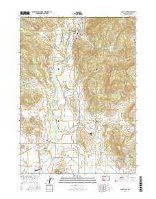
2017 Map of Shady Cove
USGS Topo · Published 2017About this map
The Rogue River carves through this portion of Jackson County, anchoring the community of Shady Cove and several small aviation strips like the Shady Cove Airpark. The landscape is defined by a complex network of water management features, including the Medford Aqueduct and numerous irrigation laterals such as Hammel Lateral and Pettigrew Lateral. These systems feed various private and utility catchments like Robinson Reservoir and Gates Reservoir, reflecting the region's reliance on managed water for agriculture and local industry.
Find a feature on this map
78 named features on this map. Tap any name to fly to it.
Don’t see what you’re looking for? This feature index may not catch every label — zoom into the map to look around manually.
Map Details
Editions of this 2017 Shady Cove Map
This is the sole edition of this map. No revisions or reprints were ever made.
Other maps of this area

1891 · Ashland
USGS Topo · 1:250,000

1893 · Ashland
USGS Topo · 1:250,000

1897 · Ashland
USGS Topo · 1:250,000

1938 · Medford
USGS Topo · 1:125,000

1943 · Trail
USGS Topo · 1:62,500

1954 · Medford
USGS Topo · 1:62,500

1954 · Butte Falls
USGS Topo · 1:62,500

1954 · Lakecreek
USGS Topo · 1:62,500

1955 · Medford
USGS Topo · 1:250,000

1957 · Medford
USGS Topo · 1:250,000