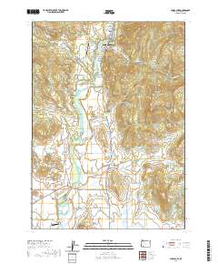
2020 Map of Shady Cove
USGS Topo · Published 2020About this map
The Rogue River defines the valley landscape of this region, providing the primary axis for development and irrigation. In the northern reaches, the community of Shady Cove serves as a central hub, supported by local infrastructure like the Shady Cove Airpark and the Johnson Cem. The map reveals a complex water management system essential for the area's agriculture and ranching, featuring the Medford Aqueduct and numerous storage sites such as Gates Reservoir, Hammel Reservoir, and the Todd Reservoir. This network of canals, including the Hammel Lateral and Pettegrew Lateral, illustrates how the land was engineered for productivity. Further south, the East Oregon Cattle Company Airport and the crossing at Dodge Bridge highlight the intersection of aviation and historic river transit. The terrain is marked by prominent elevations like Mosser Mtn and Vestal Butte, which overlook the various gulches and gap features that characterize this portion of Jackson County.
Find a feature on this map
76 named features on this map. Tap any name to fly to it.
Don’t see what you’re looking for? This feature index may not catch every label — zoom into the map to look around manually.
Map Details
Editions of this 2020 Shady Cove Map
This is the sole edition of this map. No revisions or reprints were ever made.
Other maps of this area

1891 · Ashland
USGS Topo · 1:250,000

1893 · Ashland
USGS Topo · 1:250,000

1897 · Ashland
USGS Topo · 1:250,000

1938 · Medford
USGS Topo · 1:125,000

1943 · Trail
USGS Topo · 1:62,500

1954 · Medford
USGS Topo · 1:62,500

1954 · Butte Falls
USGS Topo · 1:62,500

1954 · Lakecreek
USGS Topo · 1:62,500

1955 · Medford
USGS Topo · 1:250,000

1957 · Medford
USGS Topo · 1:250,000