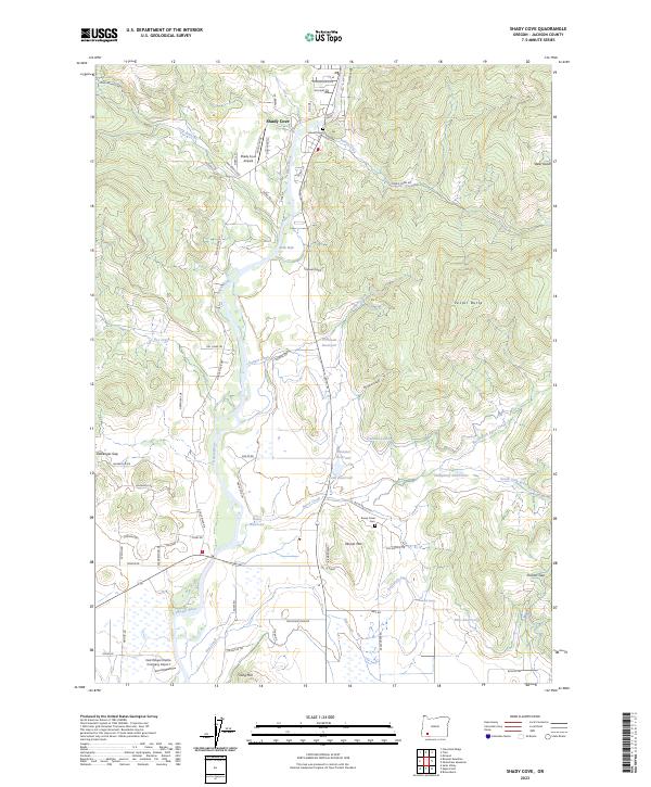
2023 Map of Shady Cove
USGS Topo · Published 2023About this map
The Rogue River carves a central path through this Jackson County landscape, anchoring the settlement of Shady Cove. This 2023 survey illustrates a complex water management system in the arid foothills, defined by numerous irrigation features like the Hammel Lateral, Pettegrew Lateral, and a series of small impoundments including Robinson Reservoir and Gates Reservoir. The terrain is marked by prominent high points such as Vestal Butte and Mosser Mtn, while aviation interests are represented by the Shady Cove Airpark and the East Oregon Cattle Company Airport. Local history is preserved at the Johnson Cem near the river and the Reese Creek Cem further south, providing fixed points for genealogical research in an area defined by its rugged gulches and seasonal creek beds like Murderer Gulch and Dry Creek.
Find a feature on this map
76 named features on this map. Tap any name to fly to it.
Don’t see what you’re looking for? This feature index may not catch every label — zoom into the map to look around manually.
Map Details
Editions of this 2023 Shady Cove Map
This is the sole edition of this map. No revisions or reprints were ever made.
Other maps of this area

1891 · Ashland
USGS Topo · 1:250,000

1893 · Ashland
USGS Topo · 1:250,000

1897 · Ashland
USGS Topo · 1:250,000

1938 · Medford
USGS Topo · 1:125,000

1943 · Trail
USGS Topo · 1:62,500

1954 · Medford
USGS Topo · 1:62,500

1954 · Butte Falls
USGS Topo · 1:62,500

1954 · Lakecreek
USGS Topo · 1:62,500

1955 · Medford
USGS Topo · 1:250,000

1957 · Medford
USGS Topo · 1:250,000