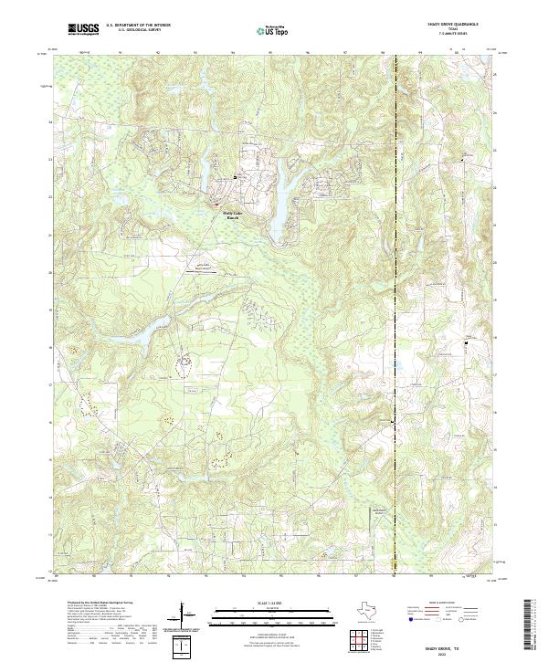
2022 Map of Shady Grove
USGS Topo · Published 2022About this map
Holly Lake Ranch and its surrounding wetlands define this East Texas landscape, where the waters of Big Sandy Cr and Boggy Cr feed a complex of smaller reservoirs and natural features. This 2022 survey documents a contemporary mix of resort-style development and traditional rural landmarks along the Wood Co and Upshur Co line. Private airstrips like the Holly Lake Ranch Airport and Hawk Ranch Airport indicate the modern character of these wooded tracts.
Find a feature on this map
121 named features on this map. Tap any name to fly to it.
Don’t see what you’re looking for? This feature index may not catch every label — zoom into the map to look around manually.
Map Details
Editions of this 2022 Shady Grove Map
This is the sole edition of this map. No revisions or reprints were ever made.
Other maps of this area

1956 · Tyler
USGS Topo · 1:250,000

1960 · Shady Grove
USGS Topo · 1:24,000

1960 · Hawkins
USGS Topo · 1:24,000

1960 · Big Sandy
USGS Topo · 1:24,000

1960 · Pritchett
USGS Topo · 1:24,000

1960 · Hainesville
USGS Topo · 1:24,000

1960 · Cartwright
USGS Topo · 1:24,000

1960 · Thomas
USGS Topo · 1:24,000

1960 · Rhonesboro
USGS Topo · 1:24,000

1960 · Crow
USGS Topo · 1:24,000