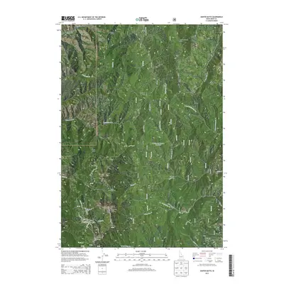
2013 Map of Shafer Butte
USGS Topo · Published 2013About this map
Boise National Forest dominates this section of the Idaho highlands, where the complex drainage patterns of Harris Cr and Macks Cr carve through high ridges. The area is defined by its significant vertical relief and recreational infrastructure, notably around the Bogus Basin area. High points like Shafer Butte, Mores Mtn, and the lookout at Deer Point serve as focal points for both regional geography and local winter sports.
Find a feature on this map
38 named features on this map. Tap any name to fly to it.
Don’t see what you’re looking for? This feature index may not catch every label — zoom into the map to look around manually.
Map Details
Editions of this 2013 Shafer Butte Map
This is the sole edition of this map. No revisions or reprints were ever made.
Other maps of this area

1892 · Boise
USGS Topo · 1:125,000

1894 · Idaho Basin
USGS Topo · 1:125,000

1897 · Boise
USGS Topo · 1:125,000

1949 · Robie Creek
USGS Topo · 1:24,000

1954 · Boise North
USGS Topo · 1:24,000

1954 · Boise
USGS Topo · 1:62,500

1955 · Hailey
USGS Topo · 1:250,000

1955 · Boise
USGS Topo · 1:250,000

1957 · Cartwright Canyon
USGS Topo · 1:24,000

1957 · Horseshoe Bend
USGS Topo · 1:24,000