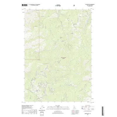
2020 Map of Shafer Butte
USGS Topo · Published 2020About this map
Shafer Butte and the surrounding high-elevation terrain of the Boise National Forest define this 2020 topographic map of the Bogus Basin area. Located on the Boise Ridge, the landscape is a complex network of ridgelines and drainages, including Harris Creek and Pine Creek. The map provides an exceptionally detailed look at the winter recreation infrastructure, documenting numerous ski runs and snow-specific routes like Nordic Highway and Sapper's Return.
Find a feature on this map
67 named features on this map. Tap any name to fly to it.
Don’t see what you’re looking for? This feature index may not catch every label — zoom into the map to look around manually.
Map Details
Editions of this 2020 Shafer Butte Map
This is the sole edition of this map. No revisions or reprints were ever made.
Other maps of this area

1892 · Boise
USGS Topo · 1:125,000

1894 · Idaho Basin
USGS Topo · 1:125,000

1897 · Boise
USGS Topo · 1:125,000

1949 · Robie Creek
USGS Topo · 1:24,000

1954 · Boise North
USGS Topo · 1:24,000

1954 · Boise
USGS Topo · 1:62,500

1955 · Hailey
USGS Topo · 1:250,000

1955 · Boise
USGS Topo · 1:250,000

1957 · Cartwright Canyon
USGS Topo · 1:24,000

1957 · Horseshoe Bend
USGS Topo · 1:24,000