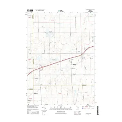
2014 Map of Shaftsburg
USGS Topo · Published 2014About this map
Shaftsburg sits at the heart of this landscape, marking a central point in a region defined by the convergence of Clinton, Shiawassee, and Ingham counties. The terrain is characterized by a high density of water features, from the meandering Looking Glass River in the north to the glacial kettle lakes like Moon Lake and Colby Lake. The transportation network is anchored by Lansing RD, which runs parallel to the rail line through Shaftsburg Station, reflecting the historically vital connection between these rural settlements and the larger regional hubs.
Find a feature on this map
91 named features on this map. Tap any name to fly to it.
Don’t see what you’re looking for? This feature index may not catch every label — zoom into the map to look around manually.
Map Details
Editions of this 2014 Shaftsburg Map
This is the sole edition of this map. No revisions or reprints were ever made.
Other maps of this area

1908 · Fowlerville
USGS Topo · 1:62,500

1909 · Mason
USGS Topo · 1:62,500

1910 · Fowlerville
USGS Topo · 1:62,500

1911 · Mason
USGS Topo · 1:62,500

1926 · Corunna
USGS Topo · 1:62,500

1928 · Laingsburg
USGS Topo · 1:62,500

1929 · Corunna
USGS Topo · 1:62,500

1944 · Laingsburg
USGS Topo · 1:62,500

1944 · Corunna
USGS Topo · 1:62,500

1958 · Grand Rapids
USGS Topo · 1:250,000