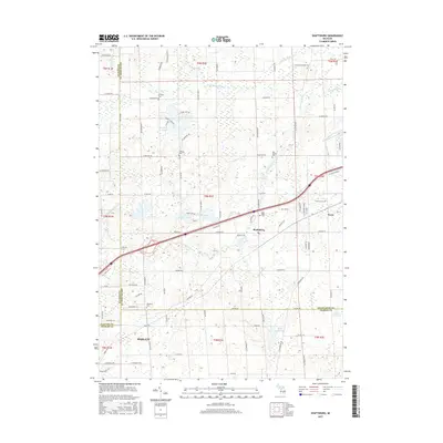
2017 Map of Shaftsburg
USGS Topo · Published 2017About this map
The Looking Glass River meanders across the northern reaches of this landscape where the borders of Shiawassee, Clinton, and Ingham counties meet. The unincorporated community of Shaftsburg serves as a central hub, situated near the Oak Plain Cem and the corridor formed by Lansing Rd and W M-78. This 2017 data reflects a region defined by its rural heritage and hydrology, featuring a network of named drains like the Osborn Cr Drain and Devore Drain that support the surrounding agricultural land. Several family and community burial sites, including the Kay Family Cem, Graham Cem, and Sprague Cem, are distributed along the section lines, offering significant points of interest for genealogical research in Woodhull and Perry townships. To the southeast, the city of Perry and the outskirts of Haslett anchor the map's corners, connected by a grid of long-established country roads such as Braden Rd and Warner Rd.
Find a feature on this map
100 named features on this map. Tap any name to fly to it.
Don’t see what you’re looking for? This feature index may not catch every label — zoom into the map to look around manually.
Map Details
Editions of this 2017 Shaftsburg Map
This is the sole edition of this map. No revisions or reprints were ever made.
Other maps of this area

1908 · Fowlerville
USGS Topo · 1:62,500

1909 · Mason
USGS Topo · 1:62,500

1910 · Fowlerville
USGS Topo · 1:62,500

1911 · Mason
USGS Topo · 1:62,500

1926 · Corunna
USGS Topo · 1:62,500

1928 · Laingsburg
USGS Topo · 1:62,500

1929 · Corunna
USGS Topo · 1:62,500

1944 · Laingsburg
USGS Topo · 1:62,500

1944 · Corunna
USGS Topo · 1:62,500

1958 · Grand Rapids
USGS Topo · 1:250,000