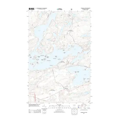
2013 Map of Shagawa Lake
USGS Topo · Published 2013About this map
Superior National Forest dominates this landscape in northeastern Minnesota, defined by the complex, island-studded waters of Burntside Lake and Shagawa Lake. Near the settlement of Ely, the terrain bears the mark of industrial history with the Pioneer Tailings Basin and Pioneer Clarification Basin, reflecting the area's mining heritage. The map documents a dense network of water bodies, from the larger Slim Lake and Fenske Lake to smaller basins like Everett Lake and Chant Lake. Transport routes including Hwy 169 and Grant Mcmahan Blvd connect the scattered homesteads and landings. Numerous named islands such as Hoodoo Island, Shipman Island, and Valentine Island dot the glacial lakes, while the Burntside River and Armstrong Cr provide the primary drainage through the wooded lowlands of Burntside.
Find a feature on this map
80 named features on this map. Tap any name to fly to it.
Don’t see what you’re looking for? This feature index may not catch every label — zoom into the map to look around manually.
Map Details
Editions of this 2013 Shagawa Lake Map
This is the sole edition of this map. No revisions or reprints were ever made.
Other maps of this area

1933 · Ely
USGS Topo · 1:62,500

1939 · Ely
USGS Topo · 1:62,500

1954 · Two Harbors
USGS Topo · 1:250,000

1954 · Hibbing
USGS Topo · 1:250,000

1954 · International Falls
USGS Topo · 1:250,000

1956 · Crab Lake
USGS Topo · 1:24,000

1956 · Eagles Nest
USGS Topo · 1:24,000

1957 · Two Harbors
USGS Topo · 1:250,000

1957 · Hibbing
USGS Topo · 1:250,000

1957 · International Falls
USGS Topo · 1:250,000