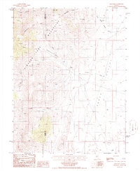
1986 Map of Shagnasty
USGS Topo · Published 1986About this map
Simpson Park dominates this high-altitude landscape along the border of Lander and Eureka counties, where the high desert terrain transitions into steep peaks. The 1986 survey reveals a network of water sources vital for ranching in this arid environment, including Springs Stock Tank and various unnamed Springs that feed into drainages like Shagnasty Creek and Ferguson Creek. Isolated ranching outposts such as Ferguson Ranch and Santa Fe Ranch are positioned near the edges of the Kobeh Valley, illustrating the historic pattern of settlement focused on reliable water and graze.
Find a feature on this map
21 named features on this map. Tap any name to fly to it.
Don’t see what you’re looking for? This feature index may not catch every label — zoom into the map to look around manually.
Map Details
Editions of this 1986 Shagnasty Map
This is the sole edition of this map. No revisions or reprints were ever made.
Other maps of this area

1926 · Roberts Mountains
USGS Topo · 1:250,000

1929 · Roberts Mountains
USGS Topo · 1:250,000

1949 · Roberts Creek Mtn
USGS Topo · 1:62,500

1951 · Roberts Creek Mtn
USGS Topo · 1:62,500

1955 · Millett
USGS Topo · 1:250,000

1956 · Bartine Ranch
USGS Topo · 1:62,500

1956 · Walti Hot Springs
USGS Topo · 1:62,500

1956 · Ackerman Canyon
USGS Topo · 1:62,500

1959 · Millett
USGS Topo · 1:250,000

1979 · Simpson Park Mtns
USGS Topo · 1:100,000