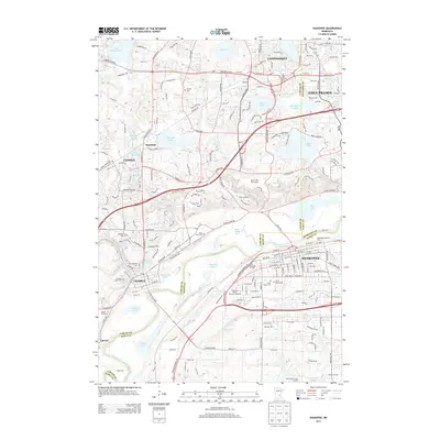
2013 Map of Shakopee
USGS Topo · Published 2013About this map
The Minnesota River flows through the heart of this suburban landscape, dividing the communities of Chaska and Shakopee as the Twin Cities metropolitan area continues its outward expansion. The industrial heritage of the valley is evident in the presence of the Brickyard Clayhole and Firemens Clayhole, remnants of the region's significant brick-making era. Numerous bodies of water dot the terrain, from larger lakes like Lake Minnewashta and Lake Riley to smaller landmarks such as Courthouse Lake and Nyssens Lake.
Find a feature on this map
96 named features on this map. Tap any name to fly to it.
Don’t see what you’re looking for? This feature index may not catch every label — zoom into the map to look around manually.
Map Details
Editions of this 2013 Shakopee Map
This is the sole edition of this map. No revisions or reprints were ever made.
Other maps of this area

1896 · Minneapolis
USGS Topo · 1:62,500

1901 · Minneapolis
USGS Topo · 1:62,500

1905 · Minnetonka
USGS Topo · 1:62,500

1907 · Minnetonka
USGS Topo · 1:62,500

1953 · Saint Paul
USGS Topo · 1:250,000

1954 · Hopkins
USGS Topo · 1:24,000

1954 · Eden Prairie
USGS Topo · 1:24,000

1954 · Minneapolis
USGS Topo · 1:62,500

1957 · Prior Lake
USGS Topo · 1:62,500

1957 · New Prague
USGS Topo · 1:62,500