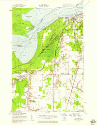
1951 Map of Shallows
USGS Topo · Published 1958About this map
The Saint Marys River and the international boundary with Canada define the northern edge of this landscape, where the Sault Ste Marie city limits meet the northern reaches of the Munuscong State Forest. The map captures a transition from the urban grid of the city, marked by the Radio Tower (WSOO) and schools like McKinley Sch, into a rural network of farmsteads and specialized religious centers.
Find a feature on this map
41 named features on this map. Tap any name to fly to it.
Don’t see what you’re looking for? This feature index may not catch every label — zoom into the map to look around manually.
Map Details
Editions of this 1951 Shallows Map
3 editions found
Other maps of this area

1913 · Sault Sainte Marie
USGS Topo · 1:62,500

1941 · Sault Sainte Marie
USGS Topo · 1:63,360

1941 · Brimley
USGS Topo · 1:63,360

1951 · Shallows
USGS Topo · 1:24,000

1951 · Kinross
USGS Topo · 1:24,000

1951 · Dafter
USGS Topo · 1:24,000

1951 · Barbeau
USGS Topo · 1:24,000

1951 · Brimley
USGS Topo · 1:62,500

1951 · Sault Ste. Marie
USGS Topo · 1:62,500

1951 · Brimley
USGS Topo · 1:24,000