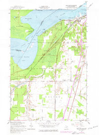
1951 Map of Shallows
USGS Topo · Published 1977About this map
The international boundary along the Saint Marys River separates the Algoma District and Chippewa County in this mid-century topographic record. The landscape is defined by the convergence of heavy rail lines, including the Duluth South Shore and Atlantic and the Minneapolis St Paul and Sault Ste Marie. In the northern section, the urban edge of Sault Ste Marie transitions into the Munuscong State Forest, featuring local landmarks like the Sherman Park Zoo and Nativity Ch. A significant military presence is visible at the Sault Ste Marie Air Force Station. Rural life south of the river is anchored by the Finnish Ch and the Pine Grove Cem near the settlement of Dafter. This survey also documents maritime hazards and infrastructure, including Submerged Cribs and Log Booms near Pointe aux Pins.
Find a feature on this map
45 named features on this map. Tap any name to fly to it.
Don’t see what you’re looking for? This feature index may not catch every label — zoom into the map to look around manually.
Map Details
Editions of this 1951 Shallows Map
3 editions found
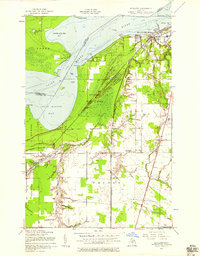
Other maps of this area

1913 · Sault Sainte Marie
USGS Topo · 1:62,500

1941 · Sault Sainte Marie
USGS Topo · 1:63,360

1941 · Brimley
USGS Topo · 1:63,360

1951 · Shallows
USGS Topo · 1:24,000

1951 · Kinross
USGS Topo · 1:24,000

1951 · Dafter
USGS Topo · 1:24,000

1951 · Barbeau
USGS Topo · 1:24,000

1951 · Brimley
USGS Topo · 1:62,500

1951 · Sault Ste. Marie
USGS Topo · 1:62,500

1951 · Brimley
USGS Topo · 1:24,000