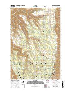
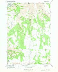
2017 Map of Shamrock Creek
USGS Topo · Published 2017About this map
Wallowa National Forest land dominates this high-altitude landscape in northeast Oregon, where a network of forest service roads and drainage basins define the geography. The terrain is structured by prominent landforms such as Day Ridge and Kuhn Ridge, which separate the various water systems feeding into the larger canyon networks of the region. Notable water sources and collection points including Reed Reservoir, Wade Pond, and Foundation Spring are scattered throughout the timbered hills, indicating the critical importance of water management in these public lands. A complex system of access roads like Courtney Creek Rd and Kuhn Ridge Rd provides the primary infrastructure for the area. The map illustrates the detailed topography of township divisions t5n r44e, t4n r44e, and t3n r44e, capturing the character of this managed forest environment during the early twenty-first century.
Find a feature on this map
24 named features on this map. Tap any name to fly to it.
Don’t see what you’re looking for? This feature index may not catch every label — zoom into the map to look around manually.
Map Details
Editions of this 2017 Shamrock Creek Map
This is the sole edition of this map. No revisions or reprints were ever made.
Other maps of this area

1955 · Grangeville
USGS Topo · 1:250,000

1957 · Sled Springs
USGS Topo · 1:62,500

1957 · Elk Mountain
USGS Topo · 1:62,500

1959 · Grangeville
USGS Topo · 1:250,000

1967 · Wood Butte
USGS Topo · 1:24,000

1967 · Troy
USGS Topo · 1:24,000
1967 · Table Mountain
USGS Topo · 1:24,000
1967 · Shamrock Creek
USGS Topo · 1:24,000
1967 · Paradise
USGS Topo · 1:24,000
1967 · Flora
USGS Topo · 1:24,000