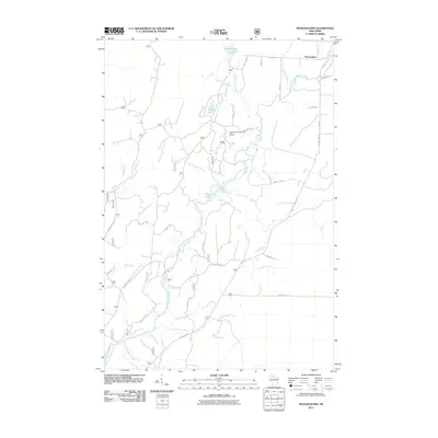
2011 Map of Shanagolden
USGS Topo · Published 2011About this map
Shanagolden marks the northern edge of this Northwoods landscape, where the East Fork Chippewa River meanders southward through a network of creeks and glacial lakes. The waterway is fed by numerous tributaries including Dryden Creek, Muskellunge Creek, and Reins Creek. This terrain is characterized by its dense water systems and a complex grid of forest roads, reflecting the region's historical reliance on timber and outdoor recreation. A Cross Country Ski Area Point of Interest is situated north of Pelican Lake, indicating the modern recreational use of these woods. The southern portion of the quadrangle is defined by the convergence of Camp Fifteen Creek and Camp Fourteen Creek, names that echo the area's logging camp heritage. Throughout the map, family-named roads like Mertig Rd and Pieper Rd suggest the enduring presence of local landholders.
Find a feature on this map
52 named features on this map. Tap any name to fly to it.
Don’t see what you’re looking for? This feature index may not catch every label — zoom into the map to look around manually.
Map Details
Editions of this 2011 Shanagolden Map
This is the sole edition of this map. No revisions or reprints were ever made.
Other maps of this area

1941 · Kennedy
USGS Topo · 1:48,000

1942 · Glidden
USGS Topo · 1:48,000

1942 · Clam Lake
USGS Topo · 1:48,000

1944 · Draper
USGS Topo · 1:48,000

1945 · Kennedy
USGS Topo · 1:48,000

1945 · Clam Lake
USGS Topo · 1:48,000

1945 · Glidden
USGS Topo · 1:48,000

1947 · Draper
USGS Topo · 1:48,000

1953 · Ashland
USGS Topo · 1:250,000

1953 · Rice Lake
USGS Topo · 1:250,000