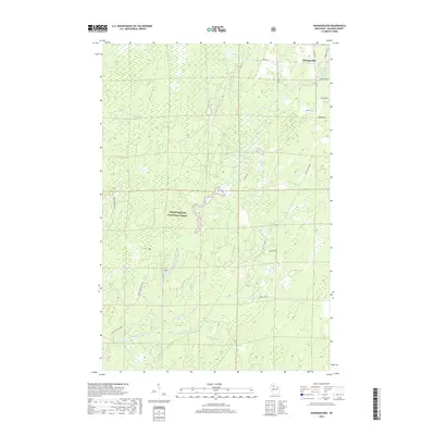
2018 Map of Shanagolden
USGS Topo · Published 2018About this map
The East Fork Chippewa River meanders through the heart of this Northwoods landscape, where the Chequamegon National Forest covers much of the terrain. The settlement of Shanagolden sits near the river's northern bend, surrounded by a network of drainage systems including Dryden Cr and Muskellunge Cr. The names of the waterways, such as Camp Fourteen Cr and Camp Fifteen Cr, hint at the historic logging camps that once operated in this section of Ashland County.
Find a feature on this map
27 named features on this map. Tap any name to fly to it.
Don’t see what you’re looking for? This feature index may not catch every label — zoom into the map to look around manually.
Map Details
Editions of this 2018 Shanagolden Map
This is the sole edition of this map. No revisions or reprints were ever made.
Other maps of this area

1941 · Kennedy
USGS Topo · 1:48,000

1942 · Glidden
USGS Topo · 1:48,000

1942 · Clam Lake
USGS Topo · 1:48,000

1944 · Draper
USGS Topo · 1:48,000

1945 · Kennedy
USGS Topo · 1:48,000

1945 · Clam Lake
USGS Topo · 1:48,000

1945 · Glidden
USGS Topo · 1:48,000

1947 · Draper
USGS Topo · 1:48,000

1953 · Ashland
USGS Topo · 1:250,000

1953 · Rice Lake
USGS Topo · 1:250,000