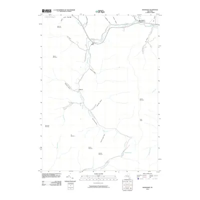
2010 Map of Shandaken
USGS Topo · Published 2010About this map
Esopus Creek carves a deep valley through the heart of the Catskills, serving as the primary corridor for settlements like Shandaken, Big Indian, and Oliverea. This 2010 topographic record shows how the steep mountain terrain dictates the layout of the region, with development clustered tightly along the valley floors near Birch Creek and Woodland Creek. To the south, high-elevation water bodies like Winnisook Lake sit near the headwaters of the West Branch Neversink River, surrounded by prominent peaks including Panther Mountain and Spruce Mountain. The map details numerous named hollows—such as Lost Clove, Peck Hollow, and Giggle Hollow—that branch off from the main creek beds, many of which are reached today by narrow roads like Mc Kenley Hollow Rd and Cruickshank Rd.
Find a feature on this map
46 named features on this map. Tap any name to fly to it.
Don’t see what you’re looking for? This feature index may not catch every label — zoom into the map to look around manually.
Map Details
Editions of this 2010 Shandaken Map
This is the sole edition of this map. No revisions or reprints were ever made.
Other maps of this area

1900 · Phoenicia
USGS Topo · 1:62,500

1901 · Margaretville
USGS Topo · 1:62,500

1903 · Phoenicia
USGS Topo · 1:62,500

1903 · Slide Mountain
USGS Topo · 1:62,500

1904 · Margaretville
USGS Topo · 1:62,500

1905 · Slide Mountain
USGS Topo · 1:62,500

1910 · Neversink
USGS Topo · 1:62,500

1942 · West Shokan
USGS Topo · 1:24,000

1942 · Neversink
USGS Topo · 1:62,500

1943 · Peekamoose Mountain
USGS Topo · 1:31,680