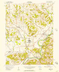
1955 Map of Shandon
USGS Topo · Published 1957About this map
Industrial and rural landscapes intersect along the Miami River corridor, defined in the mid-1950s by the presence of the U S Government Reservation (Atomic Energy Commission) at Fernald. This facility, situated between the river and the Chesapeake and Ohio railroad, represents a significant era of Cold War infrastructure in the Ohio valley. To the north and west, the terrain transitions into a dense network of family-named roads and small settlements like Shandon and Layhigh.
Find a feature on this map
73 named features on this map. Tap any name to fly to it.
Don’t see what you’re looking for? This feature index may not catch every label — zoom into the map to look around manually.
Map Details
Editions of this 1955 Shandon Map
This is the sole edition of this map. No revisions or reprints were ever made.
Other maps of this area

1914 · West Cincinnati
USGS Topo · 1:62,500

1915 · Lawrenceburg
USGS Topo · 1:48,000

1915 · Harrison
USGS Topo · 1:48,000

1915 · Hamilton
USGS Topo · 1:62,500

1917 · Hamilton
USGS Topo · 1:62,500

1928 · Lawrenceburg
USGS Topo · 1:62,500

1932 · Lawrenceburg
USGS Topo · 1:62,500

1943 · Hooven
USGS Topo · 1:24,000

1953 · Cincinnati West
USGS Topo · 1:24,000

1953 · Cincinnati
USGS Topo · 1:250,000