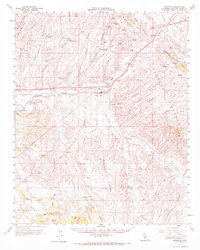
1961 Map of Shandon
USGS Topo · Published 1969About this map
The Estrella River and San Juan Creek converge near the small settlement of Shandon, defining a landscape of broad alluvial flats and complex canyon systems in eastern San Luis Obispo County. This early 1960s survey documents the agricultural and ranching footprint of the era, centered on the Shandon Flat and the surrounding hills. Family-named outposts and operations such as Upton Ranch, Alfalfa Ranch, and Canyon Ranch are scattered across the valley floors, while Whitley Gardens sits further west along the river. The presence of numerous artesian wells and named springs like Bee Tree Spring and Cement Trough Spring highlights the critical role of groundwater management in this semi-arid region. In the more remote northern reaches, the Cholame Valley and the steep Cholame Grade mark the transition toward the Diablo Range, reflecting the area's rural isolation before modern development expanded.
Find a feature on this map
76 named features on this map. Tap any name to fly to it.
Don’t see what you’re looking for? This feature index may not catch every label — zoom into the map to look around manually.
Map Details
Editions of this 1961 Shandon Map
2 editions found
Other maps of this area

1897 · San Luis Obispo
USGS Topo · 1:62,500

1900 · San Luis
USGS Topo · 1:125,000

1914 · Cholame
USGS Topo · 1:125,000

1915 · Cholame
USGS Topo · 1:125,000

1917 · Cholame
USGS Topo · 1:125,000

1919 · San Miguel
USGS Topo · 1:62,500

1919 · Paso Robles
USGS Topo · 1:62,500

1922 · Pozo
USGS Topo · 1:62,500

1932 · La Panza
USGS Topo · 1:48,000

1935 · La Panza
USGS Topo · 1:62,500