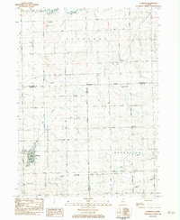
1983 Map of Shannon
USGS Topo · Published 1984About this map
The village of Shannon serves as the primary hub for this northwestern Illinois landscape, where the agricultural grid is broken by the winding paths of Lost Creek and the Leaf River. The southern portion of the territory is defined by the Chicago Milwaukee St Paul and Pacific railroad, which historically connected small trackside settlements like Harper to the wider region. An intriguing industrial detail is the presence of a Gold Mine located near the intersection of Stannard Road and Gold Mine Road, an unusual feature for the local geology.
Find a feature on this map
38 named features on this map. Tap any name to fly to it.
Don’t see what you’re looking for? This feature index may not catch every label — zoom into the map to look around manually.
Map Details
Editions of this 1983 Shannon Map
This is the sole edition of this map. No revisions or reprints were ever made.
Other maps of this area

1937 · Lena
USGS Topo · 1:48,000

1939 · Freeport
USGS Topo · 1:48,000

1942 · Mt Carroll
USGS Topo · 1:62,500

1942 · Lena
USGS Topo · 1:62,500

1942 · Forreston
USGS Topo · 1:62,500

1943 · Lena
USGS Topo · 1:62,500

1944 · Mt Carroll
USGS Topo · 1:62,500

1944 · Freeport
USGS Topo · 1:62,500

1945 · Forreston
USGS Topo · 1:62,500

1954 · Rockford
USGS Topo · 1:250,000