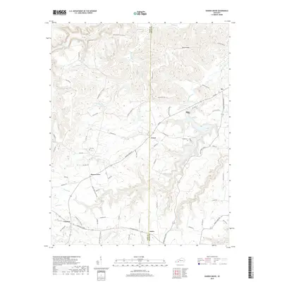
2019 Map of Sharon Grove
USGS Topo · Published 2019About this map
Sharon Grove and the surrounding agricultural communities of Todd and Logan Counties are depicted here at the close of the 2010s. The landscape is defined by the winding drainages of Wolf Lick Creek and the N Fork Whippoorwill Cr, which carve through a network of ridges such as Duncan Ridge. Small rural settlements like Everett, Claymour, and Justice are connected by a dense web of local roads, many bearing family names that suggest a long history of settlement and land ownership. Local genealogy is supported by the presence of several well-marked burial sites, including Gant Cem, Irvin Cem, and Tunstill Cem, which serve as quiet landmarks among the fields and woodlots. The map also captures the distinct boundary between Todd and Logan Counties, illustrating how these administrative lines intersect with natural features like Clifty Cr and Antioch Cr.
Find a feature on this map
69 named features on this map. Tap any name to fly to it.
Don’t see what you’re looking for? This feature index may not catch every label — zoom into the map to look around manually.
Map Details
Editions of this 2019 Sharon Grove Map
This is the sole edition of this map. No revisions or reprints were ever made.
Other maps of this area

1911 · Drakesboro
USGS Topo · 1:48,000

1911 · Dunmor
USGS Topo · 1:48,000

1913 · Drakesboro
USGS Topo · 1:62,500

1914 · Dunmor
USGS Topo · 1:62,500

1950 · Olmstead
USGS Topo · 1:24,000

1951 · Elkton
USGS Topo · 1:24,000

1951 · Olmstead
USGS Topo · 1:24,000

1951 · Lewisburg
USGS Topo · 1:24,000

1952 · Russellville
USGS Topo · 1:24,000

1952 · Sharon Grove
USGS Topo · 1:24,000