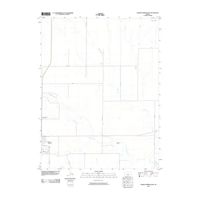
2009 Map of Sharon Springs East
USGS Topo · Published 2009About this map
Sharon Springs serves as the focal point of this Western Kansas landscape, situated near the confluence of several significant prairie waterways. The town's grid is clearly defined by streets such as Pine St and Ash St, while the local history of the community is anchored at the Sharon Springs Cemetery. The importance of the railroad in this high plains region is evidenced by the presence of Samena Siding to the east of the town center.
Find a feature on this map
23 named features on this map. Tap any name to fly to it.
Don’t see what you’re looking for? This feature index may not catch every label — zoom into the map to look around manually.
Map Details
Editions of this 2009 Sharon Springs East Map
This is the sole edition of this map. No revisions or reprints were ever made.
Other maps of this area

1954 · Goodland
USGS Topo · 1:250,000

1955 · Scott City
USGS Topo · 1:250,000

1956 · Goodland
USGS Topo · 1:250,000

1957 · Goodland
USGS Topo · 1:250,000

1958 · Scott City
USGS Topo · 1:250,000

1959 · Weskan
USGS Topo · 1:62,500

1959 · Wallace
USGS Topo · 1:62,500

1959 · Harris Draw
USGS Topo · 1:62,500

1959 · Horsethief Draw
USGS Topo · 1:62,500
1979 · Wallace
USGS Topo · 1:24,000