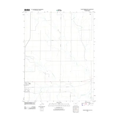
2012 Map of Sharon Springs East
USGS Topo · Published 2012About this map
Sharon Springs serves as the primary hub in this western Kansas landscape, where the grid of the High Plains meets the winding path of the Smoky Hill River. The map details the town's residential core with streets like Walnut St and Maple St, while the surrounding terrain is defined by the drainage of Pond Cr and the prominent Red Hills to the northeast. Transportation and industry are centered on the rail corridor, noted by the presence of Samena Siding east of the main settlement. This area highlights the transition between organized township roads, such as Road WA-N21 and Wa S-22, and the natural flow of smaller waterways like Eagletail Cr and Rose Cr as they feed into the larger river basin.
Find a feature on this map
19 named features on this map. Tap any name to fly to it.
Don’t see what you’re looking for? This feature index may not catch every label — zoom into the map to look around manually.
Map Details
Editions of this 2012 Sharon Springs East Map
This is the sole edition of this map. No revisions or reprints were ever made.
Other maps of this area

1954 · Goodland
USGS Topo · 1:250,000

1955 · Scott City
USGS Topo · 1:250,000

1956 · Goodland
USGS Topo · 1:250,000

1957 · Goodland
USGS Topo · 1:250,000

1958 · Scott City
USGS Topo · 1:250,000

1959 · Weskan
USGS Topo · 1:62,500

1959 · Wallace
USGS Topo · 1:62,500

1959 · Harris Draw
USGS Topo · 1:62,500

1959 · Horsethief Draw
USGS Topo · 1:62,500
1979 · Wallace
USGS Topo · 1:24,000