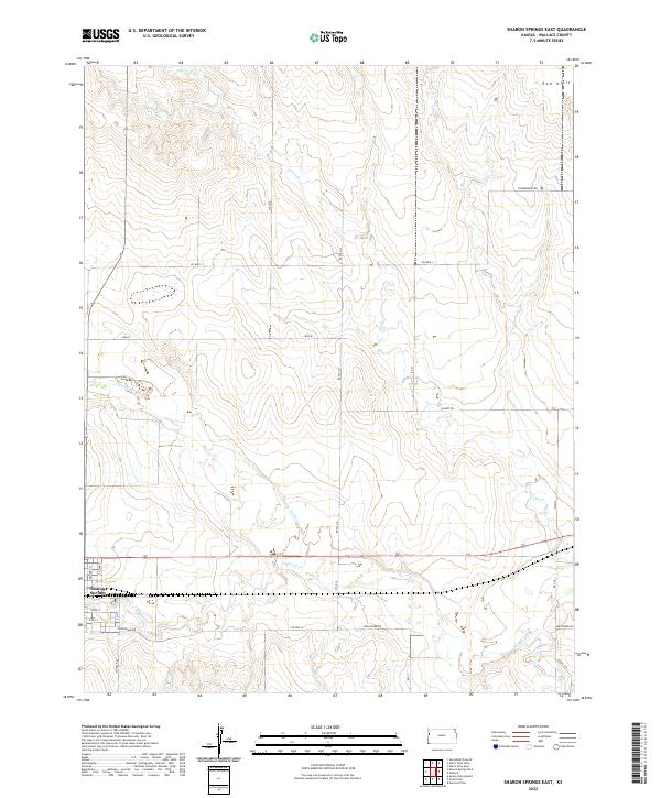
2022 Map of Sharon Springs East
USGS Topo · Published 2022About this map
Sharon Springs marks the western edge of this High Plains landscape, where the town grid meets a network of watercourses and rural roads. The most prominent hydrological feature is the Smoky Hill River, which courses through the southern portion of the quadrangle alongside its tributaries, Eagletail Cr and Rose Cr. To the north, Pond Cr meanders through the central sections, carving subtle relief into the open terrain. The northeast corner is defined by the Red Hills, a localized elevation that breaks the generally steady topography of the region. The map documents a structured land system of township and range boundaries, including t13s r40w and t13s r39w, interconnected by local routes such as Quartz Rd and Tumbleweed Rd. This 2022 survey provides an updated record of land use and water management in Wallace County, illustrating how modern infrastructure like Nighthawk Rd aligns with the natural flow of the western Kansas plains.
Find a feature on this map
29 named features on this map. Tap any name to fly to it.
Don’t see what you’re looking for? This feature index may not catch every label — zoom into the map to look around manually.
Map Details
Editions of this 2022 Sharon Springs East Map
This is the sole edition of this map. No revisions or reprints were ever made.
Other maps of this area

1954 · Goodland
USGS Topo · 1:250,000

1955 · Scott City
USGS Topo · 1:250,000

1956 · Goodland
USGS Topo · 1:250,000

1957 · Goodland
USGS Topo · 1:250,000

1958 · Scott City
USGS Topo · 1:250,000

1959 · Weskan
USGS Topo · 1:62,500

1959 · Wallace
USGS Topo · 1:62,500

1959 · Harris Draw
USGS Topo · 1:62,500

1959 · Horsethief Draw
USGS Topo · 1:62,500
1979 · Wallace
USGS Topo · 1:24,000