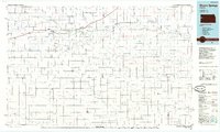
1985 Map of Sharon Springs
USGS Topo · Published 1985About this map
The Smoky Hill River corridor defines this portion of western Kansas, where the historic Butterfield Overland Trail and the Union Pacific railroad track the same east-west path of migration and commerce. High plains topography is punctuated by drainage systems like Ladder Creek and Chalk Creek, which carve through the Harrison Flats and South Flats. The map highlights the frontier legacy of the region at the Fort Wallace (site), located just west of the town of Wallace.
Find a feature on this map
50 named features on this map. Tap any name to fly to it.
Don’t see what you’re looking for? This feature index may not catch every label — zoom into the map to look around manually.
Map Details
Editions of this 1985 Sharon Springs Map
2 editions found
Other maps of this area

1890 · Granada
USGS Topo · 1:125,000

1892 · Cheyenne Wells
USGS Topo · 1:125,000

1892 · Granada
USGS Topo · 1:125,000

1894 · Cheyenne Wells
USGS Topo · 1:125,000

1894 · Granada
USGS Topo · 1:125,000

1939 · Lake Mc Bride
USGS Topo · 1:24,000

1939 · Sandon
USGS Topo · 1:62,500

1939 · Pence
USGS Topo · 1:62,500

1940 · Scott City
USGS Topo · 1:62,500

1941 · Modoc
USGS Topo · 1:62,500