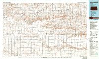
1985 Map of Sharon Springs
USGS Topo · Published 1989About this map
The Smoky Hill River and its various tributaries carve through the High Plains landscape of Western Kansas, defining a region where transportation history and geography are deeply intertwined. This mid-1980s data highlights the approximate route of the Butterfield Overland Trail and the Butterfield Old Trail, historical paths that predated the Union Pacific Railroad corridor running through Sharon Springs and Weskan. The map captures the transition from the Harrison Flats to the more dissected terrain of the Red Hills and Chalk Buttes, providing a clear view of the drainage patterns of Ladder Creek and Pond Creek. Genealogical interest is found in the scattered settlements like Russell Springs and Logansport, alongside the historic Fort Wallace (Site). Land use is further illustrated by the Logan County State Fishing Lake and Wildlife Area and several small aviation landmarks like the Walker Landing Strip.
Find a feature on this map
55 named features on this map. Tap any name to fly to it.
Don’t see what you’re looking for? This feature index may not catch every label — zoom into the map to look around manually.
Map Details
Editions of this 1985 Sharon Springs Map
2 editions found
Other maps of this area

1890 · Granada
USGS Topo · 1:125,000

1892 · Cheyenne Wells
USGS Topo · 1:125,000

1892 · Granada
USGS Topo · 1:125,000

1894 · Cheyenne Wells
USGS Topo · 1:125,000

1894 · Granada
USGS Topo · 1:125,000

1939 · Lake Mc Bride
USGS Topo · 1:24,000

1939 · Sandon
USGS Topo · 1:62,500

1939 · Pence
USGS Topo · 1:62,500

1940 · Scott City
USGS Topo · 1:62,500

1941 · Modoc
USGS Topo · 1:62,500