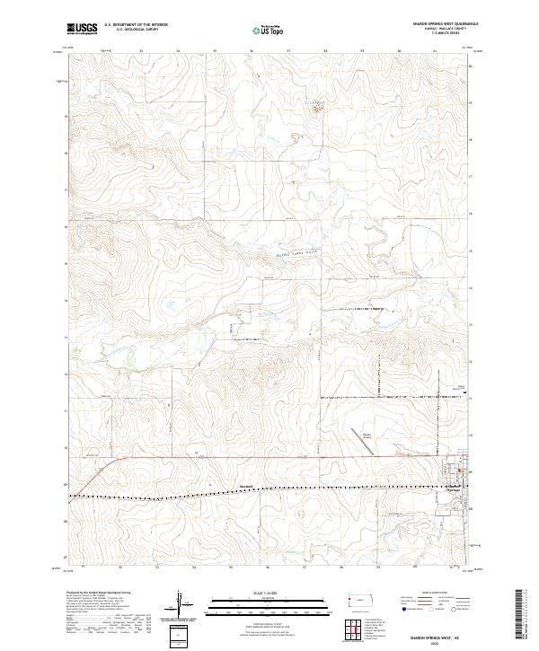
2022 Map of Sharon Springs West
USGS Topo · Published 2022About this map
Sharon Springs serves as the primary hub of this High Plains landscape in Wallace County, where the residential grid meets the arterial path of Old US Hwy 40. To the west, the smaller settlement of Sunland sits along the same highway corridor, reflecting the sparse, wide-interval development typical of this western Kansas prairie. The drainage of the Smoky Hill River cuts through the center of the sheet, joined by smaller tributaries like Goose Cr and Eagletail Cr. Notable local landmarks include the Bussen Airport and the Sharon Springs Cem on the eastern edge of the survey. The terrain is marked by distinctive features such as Rattle Snake Gulch and the seasonal waters of Old Maid Pool, illustrating the transition from open grazing land to the eroded breaks of the river valley.
Find a feature on this map
28 named features on this map. Tap any name to fly to it.
Don’t see what you’re looking for? This feature index may not catch every label — zoom into the map to look around manually.
Map Details
Editions of this 2022 Sharon Springs West Map
This is the sole edition of this map. No revisions or reprints were ever made.
Other maps of this area

1954 · Goodland
USGS Topo · 1:250,000

1955 · Scott City
USGS Topo · 1:250,000

1956 · Goodland
USGS Topo · 1:250,000

1957 · Goodland
USGS Topo · 1:250,000

1958 · Scott City
USGS Topo · 1:250,000

1959 · Weskan
USGS Topo · 1:62,500

1959 · Wallace
USGS Topo · 1:62,500

1959 · Harris Draw
USGS Topo · 1:62,500

1959 · Horsethief Draw
USGS Topo · 1:62,500
1979 · Sharon Springs West
USGS Topo · 1:24,000