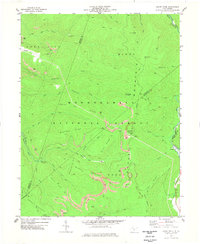
1977 Map of Sharp Knob
USGS Topo · Published 1978About this map
Sharp Knob and the surrounding Monongahela National Forest dominate this mid-1970s survey, illustrating a landscape defined by industrial extraction and high-altitude terrain. The presence of numerous Strip Mines and several mines throughout the Mingo Mountain and Edray Mountains ranges reflects the area's coal and timber focus. Resource transport is evidenced by the Western Maryland Railroad Grade and an Old Railroad Grade that snake through the valleys of Bergoo Creek and the Gauley River. Atop the peak, the Sharp Knob Lookout Tower serves as a primary landmark, overlooking the complex drainage systems of the North Fork Gauley River and South Fork Gauley River. The map also captures the tri-county boundary where Webster, Randolph, and Pocahontas counties meet near the Gauley River headwaters.
Find a feature on this map
43 named features on this map. Tap any name to fly to it.
Don’t see what you’re looking for? This feature index may not catch every label — zoom into the map to look around manually.
Map Details
Editions of this 1977 Sharp Knob Map
This is the sole edition of this map. No revisions or reprints were ever made.
Other maps of this area

1891 · Huntersville
USGS Topo · 1:125,000

1893 · Buckhannon
USGS Topo · 1:125,000

1894 · Huntersville
USGS Topo · 1:125,000

1896 · Buckhannon
USGS Topo · 1:125,000

1897 · Buckhannon
USGS Topo · 1:125,000

1913 · Hacker Valley
USGS Topo · 1:48,000

1913 · Pickens
USGS Topo · 1:48,000

1915 · Webster Springs
USGS Topo · 1:48,000

1915 · Hacker Valley
USGS Topo · 1:62,500

1915 · Pickens
USGS Topo · 1:62,500