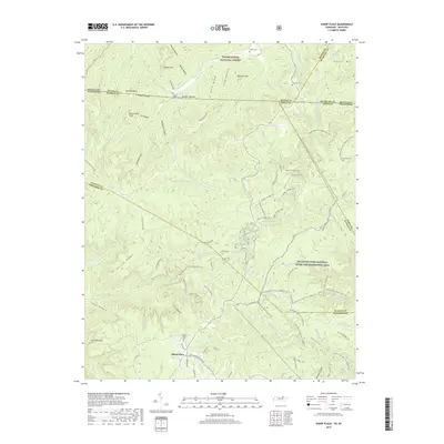
2019 Map of Sharp Place
USGS Topo · Published 2019About this map
Sharp Place sits along the Tennessee-Kentucky border in a landscape defined by deep hollers and high cliffs within the Big South Fork National River and Recreation Area and Daniel Boone National Forest. This 2019 survey captures the convergence of Fentress, Pickett, and Scott Counties in Tennessee with Wayne and McCreary Counties in Kentucky. The area is a network of ridges and watercourses, including the S Prong Little Rock Cr and Thompson Cr, marked by topographic features like Chimney Rock and Greenwood Cliff.
Find a feature on this map
109 named features on this map. Tap any name to fly to it.
Don’t see what you’re looking for? This feature index may not catch every label — zoom into the map to look around manually.
Map Details
Editions of this 2019 Sharp Place Map
This is the sole edition of this map. No revisions or reprints were ever made.
Other maps of this area

1895 · Wartburg
USGS Topo · 1:125,000

1896 · Wartburg
USGS Topo · 1:125,000

1934 · Barthell
USGS Topo · 1:62,500

1934 · Pall Mall
USGS Topo · 1:62,500

1952 · Honey Creek
USGS Topo · 1:24,000

1954 · Stockton
USGS Topo · 1:24,000

1954 · Parmleysville
USGS Topo · 1:24,000

1954 · Jamestown
USGS Topo · 1:24,000

1954 · Powersburg
USGS Topo · 1:24,000

1954 · Bell Farm
USGS Topo · 1:24,000