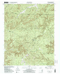
2000 Map of Sharp Place
USGS Topo · Published 2001About this map
Sharp Place sits at the heart of this rugged borderland where the Cumberland Plateau meets the Kentucky-Tennessee state line. The landscape is defined by its dramatic relief, featuring prominent landmarks like Yellow Cliff and Pinnacle Mtn, while the Big South Fork and Rock Creek carve deep into the terrain. This survey reveals a pattern of dispersed rural settlement typical of the Upper Cumberland region, anchored by community institutions such as Akers Chapel, Langham Sch, and Sharp Sch.
Find a feature on this map
55 named features on this map. Tap any name to fly to it.
Don’t see what you’re looking for? This feature index may not catch every label — zoom into the map to look around manually.
Map Details
Editions of this 2000 Sharp Place Map
This is the sole edition of this map. No revisions or reprints were ever made.
Other maps of this area

1895 · Wartburg
USGS Topo · 1:125,000

1896 · Wartburg
USGS Topo · 1:125,000

1934 · Barthell
USGS Topo · 1:62,500

1934 · Pall Mall
USGS Topo · 1:62,500

1952 · Honey Creek
USGS Topo · 1:24,000

1954 · Stockton
USGS Topo · 1:24,000

1954 · Parmleysville
USGS Topo · 1:24,000

1954 · Jamestown
USGS Topo · 1:24,000

1954 · Powersburg
USGS Topo · 1:24,000

1954 · Bell Farm
USGS Topo · 1:24,000