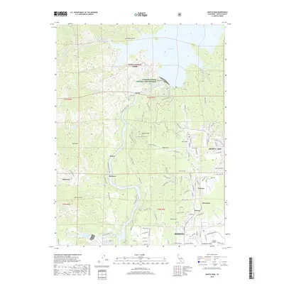
2018 Map of Shasta Dam
USGS Topo · Published 2018About this map
The monumental Shasta Dam anchors this landscape, holding back the waters of Shasta Lake at the northern reaches of the Central Valley. Below the dam, the Sacramento River flows south toward Redding, winding past industrial sites and historical settlement points. Along its banks, the Livingston Stone National Fish Hatchery and several rail-side locations such as Coram, Motion, and Matheson reflect the area's long association with resource management and transport. The terrain is marked by steep ridges and gulches within the Shasta National Forest, including heights like Chamise Peak and Copley Mtn. To the southeast, the growing residential footprints of Newtown, Silverthorn, and Buckeye emerge, while the Spring Creek Reservoir and the Sacramento River Trail illustrate the contemporary balance between water infrastructure and recreational access.
Find a feature on this map
114 named features on this map. Tap any name to fly to it.
Don’t see what you’re looking for? This feature index may not catch every label — zoom into the map to look around manually.
Map Details
Editions of this 2018 Shasta Dam Map
This is the sole edition of this map. No revisions or reprints were ever made.
Other maps of this area

1890 · Red Bluff
USGS Topo · 1:250,000

1894 · Red Bluff
USGS Topo · 1:250,000

1901 · Redding
USGS Topo · 1:125,000

1913 · Weaverville
USGS Topo · 1:125,000

1944 · Redding
USGS Topo · 1:62,500

1944 · French Gulch
USGS Topo · 1:62,500

1946 · Lamoine
USGS Topo · 1:62,500

1946 · Redding
USGS Topo · 1:62,500

1948 · French Gulch
USGS Topo · 1:62,500

1950 · Schell Mtn
USGS Topo · 1:62,500