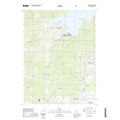
2021 Map of Shasta Dam
USGS Topo · Published 2021About this map
The Sacramento River carves a deep path through Shasta County in this 2021 record, flowing south from the massive Shasta Lake reservoir toward the growing northern edge of Redding. The landscape is defined by the legacy of resource management and early industrial sites, featuring the Livingston Stone National Fish Hatchery and several settlements along the river's banks. Former mining and rail outposts like Matheson and Coram are visible alongside the old Rail Trail, reflecting the area's transition from an extractive economy to one centered on water infrastructure and recreation.
Find a feature on this map
101 named features on this map. Tap any name to fly to it.
Don’t see what you’re looking for? This feature index may not catch every label — zoom into the map to look around manually.
Map Details
Editions of this 2021 Shasta Dam Map
This is the sole edition of this map. No revisions or reprints were ever made.
Other maps of this area

1890 · Red Bluff
USGS Topo · 1:250,000

1894 · Red Bluff
USGS Topo · 1:250,000

1901 · Redding
USGS Topo · 1:125,000

1913 · Weaverville
USGS Topo · 1:125,000

1944 · Redding
USGS Topo · 1:62,500

1944 · French Gulch
USGS Topo · 1:62,500

1946 · Lamoine
USGS Topo · 1:62,500

1946 · Redding
USGS Topo · 1:62,500

1948 · French Gulch
USGS Topo · 1:62,500

1950 · Schell Mtn
USGS Topo · 1:62,500