
1921 Map of Shasta Valley Sheet No 7
USGS Topo · Published 1921About this map
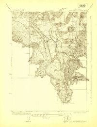
Parks Creek and the Little Shasta River define the intricate drainage patterns of this northern California landscape, surveyed in 1921. At this time, the region was being closely studied by the U.S. Reclamation Service and the Klamath-Shasta Valley Irrigation District, as evidenced by the extreme detail in the terrain contours and the identification of localized water resources. The settlement pattern is sparse, dominated by significant family holdings such as Dukes Ranch, which stands as a central landmark in the valley. The presence of Big Springs in the northeastern corner suggests a critical water source for the ranching and irrigation efforts of the early twentieth century. This map captures the territory before extensive modern irrigation projects fully reshaped the hydraulic character of the valley, providing a detailed look at the original watercourses and early property distributions.
Find a feature on this map
4 named features on this map. Tap any name to fly to it.
Don’t see what you’re looking for? This feature index may not catch every label — zoom into the map to look around manually.
Map Details
Editions of this 1921 Shasta Valley Sheet No 7 Map
This is the sole edition of this map. No revisions or reprints were ever made.
Other maps of this area

1886 · Shasta
USGS Topo · 1:250,000

1894 · Shasta
USGS Topo · 1:250,000

1921 · Shasta Valley Sheet No 11
USGS Topo · 1:24,000

1921 · Shasta Valley Sheet No 1
USGS Topo · 1:24,000

1921 · Shasta Valley Sheet No 6
USGS Topo · 1:24,000

1921 · Shasta Valley Sheet No 2
USGS Topo · 1:24,000

1922 · Shasta Valley Sheet No 10
USGS Topo · 1:24,000

1922 · Shasta Valley Sheet No 1 S
USGS Topo · 1:24,000

1922 · Shasta Valley Sheet No 9
USGS Topo · 1:24,000
1922 · Shasta Valley Sheet No 8
USGS Topo · 1:24,000