
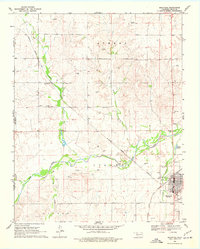
1969 Map of Shattuck
USGS Topo · Published 1971About this map
Shattuck and the surrounding plains of Ellis County are defined by the convergence of major drainage systems and rail infrastructure as they appeared in the late 1960s. The Atchison Topeka and Santa Fe railroad bisects the landscape, following the course of Ivanhoe Creek and Wolf Creek toward the town center. The presence of numerous Caliche Pits, Gas Wells, and a Sandpit indicate a diversified local economy driven by extraction and energy production alongside the established agricultural township.
Find a feature on this map
29 named features on this map. Tap any name to fly to it.
Don’t see what you’re looking for? This feature index may not catch every label — zoom into the map to look around manually.
Map Details
Editions of this 1969 Shattuck Map
2 editions found
Other maps of this area

1954 · Perryton
USGS Topo · 1:250,000

1955 · Woodward
USGS Topo · 1:250,000

1958 · Perryton
USGS Topo · 1:250,000

1958 · Woodward
USGS Topo · 1:250,000

1969 · Shattuck NW
USGS Topo · 1:24,000

1969 · Gage
USGS Topo · 1:24,000

1969 · Shattuck NE
USGS Topo · 1:24,000

1970 · Arnett
USGS Topo · 1:24,000

1970 · Goodwin
USGS Topo · 1:24,000

1972 · Follett SE
USGS Topo · 1:24,000