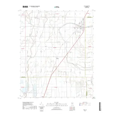
2018 Map of Shaw
USGS Topo · Published 2018About this map
Shaw sits at the junction of several county lines in the heart of the Mississippi Delta, defined by a complex network of bayous and agricultural roads. The town is flanked by the winding course of Porter Bayou, with the larger Bogue Phalia and Bogue Hasty draining the alluvial plains to the west. This landscape, shaped by decades of cotton farming and drainage management, features several small, historically significant settlements including Choctaw and Busey. Local family and community history is preserved at the Strangers Rest Cem near the town center and the Mexican Cem further west, reflecting the area's diverse demographic history. The map also captures the transition between the agricultural hinterland and local infrastructure, such as Tapley Airport and the rail corridors represented by Railroad Ave. Southward, the terrain reaches the settlements of Helm and Napanee, where the Old Water Bayou and W Prong Indian Bayou further carve the flat, fertile territory.
Find a feature on this map
77 named features on this map. Tap any name to fly to it.
Don’t see what you’re looking for? This feature index may not catch every label — zoom into the map to look around manually.
Map Details
Editions of this 2018 Shaw Map
This is the sole edition of this map. No revisions or reprints were ever made.
Other maps of this area

1934 · Cleveland
USGS Topo · 1:62,500

1939 · Tralake
USGS Topo · 1:62,500

1939 · Choctaw
USGS Topo · 1:62,500

1940 · Baird
USGS Topo · 1:62,500

1940 · Cleveland
USGS Topo · 1:62,500

1953 · Greenwood
USGS Topo · 1:250,000

1956 · Greenwood
USGS Topo · 1:250,000

1965 · Indianola
USGS Topo · 1:24,000

1966 · Cleveland
USGS Topo · 1:24,000

1967 · Baird
USGS Topo · 1:62,500