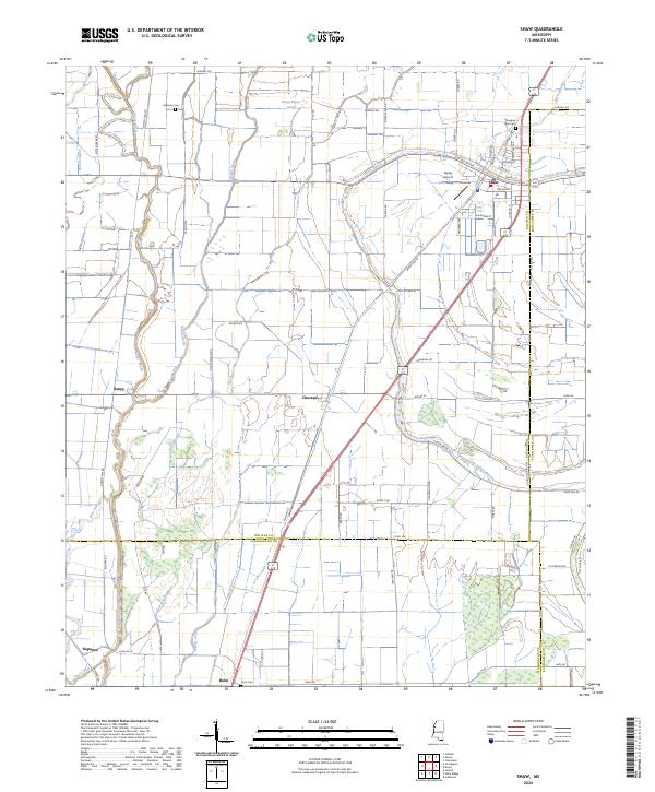
2024 Map of Shaw
USGS Topo · Published 2024About this map
Shaw sits at the intersection of Bolivar and Sunflower counties, serving as a primary hub in this agricultural landscape defined by complex waterway networks. The town is oriented around a grid of streets such as Dean Blvd and Faison St, with the Tapley Airport located just to the west. The surrounding Delta terrain is etched by the meandering courses of Bogue Phalia and Porter Bayou, which dictated the early settlement patterns and the placement of rural communities like Choctaw and Busey. Evidence of long-standing local communities is found in the scattered burial grounds, including Mexican Cem and Strangers Rest Cem. The southern portion of the map transitions into Washington County, where the settlement of Helm is situated near Helm Cem. This modern survey maintains the names of historical transport routes like Dummy Line Rd, a nod to the area's timber and rail history.
Find a feature on this map
77 named features on this map. Tap any name to fly to it.
Don’t see what you’re looking for? This feature index may not catch every label — zoom into the map to look around manually.
Map Details
Editions of this 2024 Shaw Map
This is the sole edition of this map. No revisions or reprints were ever made.
Other maps of this area

1934 · Cleveland
USGS Topo · 1:62,500

1939 · Tralake
USGS Topo · 1:62,500

1939 · Choctaw
USGS Topo · 1:62,500

1940 · Baird
USGS Topo · 1:62,500

1940 · Cleveland
USGS Topo · 1:62,500

1953 · Greenwood
USGS Topo · 1:250,000

1956 · Greenwood
USGS Topo · 1:250,000

1965 · Indianola
USGS Topo · 1:24,000

1966 · Cleveland
USGS Topo · 1:24,000

1967 · Baird
USGS Topo · 1:62,500