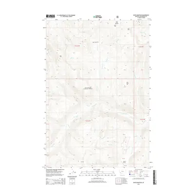
2014 Map of Shaw Mountain
USGS Topo · Published 2014About this map
Beaverhead National Forest land dominates this high-elevation reach of Beaverhead County, defined by a complex network of creeks and prominent summits. The northern boundary is anchored by the Alder Meadows and Alder Peak, while the center of the sheet features the recreational grounds of Bible Camp Park. The terrain is shaped by numerous watercourses, including Pettengill Creek and Lost Horse Cr, which flow through the steep drainages. Further south, the landscape opens into Fox Park and the curiously named Jerked Prairie. High peaks like Shaw Mtn and Lost Horse Mtn provide clear landmarks for understanding the local topography. This 2014 survey illustrates the intricate drainage patterns of the Continental Divide region, where small seasonal streams like Whiskey Cr and Demijohn Cr feed into larger creek systems.
Find a feature on this map
79 named features on this map. Tap any name to fly to it.
Don’t see what you’re looking for? This feature index may not catch every label — zoom into the map to look around manually.
Map Details
Editions of this 2014 Shaw Mountain Map
This is the sole edition of this map. No revisions or reprints were ever made.
Other maps of this area

1955 · Dillon
USGS Topo · 1:250,000

1957 · Dillon
USGS Topo · 1:250,000

1958 · Dillon
USGS Topo · 1:250,000

1962 · Dillon
USGS Topo · 1:250,000

1962 · Pine Hill
USGS Topo · 1:24,000
1962 · Dickie Hills
USGS Topo · 1:24,000

1962 · Stewart Mountain
USGS Topo · 1:24,000
1962 · Foolhen Mountain
USGS Topo · 1:24,000

1962 · Proposal Rock
USGS Topo · 1:24,000

1965 · Dillon
USGS Topo · 1:250,000