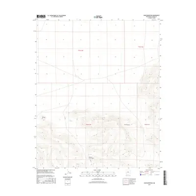
2017 Map of Shaw Mountain
USGS Topo · Published 2017About this map
Shaw Mountain and Eds Peak anchor this high-elevation corner of Catron County, where the southern terrain is defined by complex drainage systems and deep cuts. The landscape transitions from relatively open township sections in the north to the rugged topography of the Shaw Canyon and Fullerton Spring Canyon systems. Published by the U.S. Geological Survey, this 2017 edition details the public land survey system across portions of t5s r12w and t6s r11w, illustrating how the land was partitioned in this sparsely populated high-desert region. The map preserves the exact alignment of drainage basins and peaks, providing a precise topographic view of a territory primarily shaped by its hydrology and mountain landmarks.
Find a feature on this map
8 named features on this map. Tap any name to fly to it.
Don’t see what you’re looking for? This feature index may not catch every label — zoom into the map to look around manually.
Map Details
Editions of this 2017 Shaw Mountain Map
This is the sole edition of this map. No revisions or reprints were ever made.
Other maps of this area

1918 · Pelona
USGS Topo · 1:125,000

1954 · Tularosa
USGS Topo · 1:250,000

1954 · Clifton
USGS Topo · 1:250,000

1957 · Clifton
USGS Topo · 1:250,000

1958 · Clifton
USGS Topo · 1:250,000

1958 · Tularosa
USGS Topo · 1:250,000

1962 · Clifton
USGS Topo · 1:250,000

1979 · San Mateo Mountains
USGS Topo · 1:100,000

1981 · Fullerton
USGS Topo · 1:24,000
1981 · Luera Mountains NW
USGS Topo · 1:24,000