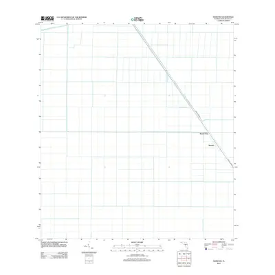
2012 Map of Shawano
USGS Topo · Published 2012About this map
Browns Farm and the settlement of Shawano anchor this 2012 study of the agricultural landscape in Palm Beach County. The area is defined by a strict geometric grid of drainage canals and fields, a hallmark of the reclaimed Everglades territory where water management is paramount for land use. The Hillsboro Canal cuts diagonally through this orthogonal pattern, serving as a primary hydrological artery for the region. Parallel to this waterway, Browns Farm Rd provides the principal overland transit route through this specialized farming district. The map reveals the precise intersection of engineering and agriculture, where the land is meticulously partitioned to support large-scale production in the Florida interior.
Find a feature on this map
4 named features on this map. Tap any name to fly to it.
Don’t see what you’re looking for? This feature index may not catch every label — zoom into the map to look around manually.
Map Details
Editions of this 2012 Shawano Map
This is the sole edition of this map. No revisions or reprints were ever made.
Other maps of this area

1956 · West Palm Beach
USGS Topo · 1:250,000

1957 · West Palm Beach
USGS Topo · 1:250,000

1958 · West Palm Beach
USGS Topo · 1:250,000

1970 · Belle Glade
USGS Topo · 1:24,000

1970 · Okeelanta
USGS Topo · 1:24,000

1970 · Loxahatchee NW
USGS Topo · 1:24,000

1970 · Loxahatchee SW
USGS Topo · 1:24,000

1970 · Shawano
USGS Topo · 1:24,000

1970 · Sixmile Bend
USGS Topo · 1:24,000

1974 · Everglades 1 NW
USGS Topo · 1:24,000