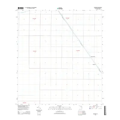
2015 Map of Shawano
USGS Topo · Published 2015About this map
Hillsboro Canal cuts a diagonal path through this corner of the Florida Everglades, defining the local infrastructure and settlement patterns. The landscape is characterized by a precise grid of drainage and irrigation, centered around the small agricultural outposts of Browns Farm and Shawano. These settlements sit along Browns Farm Rd, which parallels the canal, highlighting the critical relationship between water management and land use in this part of Palm Beach County. To the north, the Bolles Canal marks another significant piece of the region's hydraulic engineering. This survey provides a clear view of the section lines and township boundaries, such as t44s r38e, which organize the vast agricultural tracts that dominate the terrain.
Find a feature on this map
10 named features on this map. Tap any name to fly to it.
Don’t see what you’re looking for? This feature index may not catch every label — zoom into the map to look around manually.
Map Details
Editions of this 2015 Shawano Map
This is the sole edition of this map. No revisions or reprints were ever made.
Other maps of this area

1956 · West Palm Beach
USGS Topo · 1:250,000

1957 · West Palm Beach
USGS Topo · 1:250,000

1958 · West Palm Beach
USGS Topo · 1:250,000

1970 · Belle Glade
USGS Topo · 1:24,000

1970 · Okeelanta
USGS Topo · 1:24,000

1970 · Loxahatchee NW
USGS Topo · 1:24,000

1970 · Loxahatchee SW
USGS Topo · 1:24,000

1970 · Shawano
USGS Topo · 1:24,000

1970 · Sixmile Bend
USGS Topo · 1:24,000

1974 · Everglades 1 NW
USGS Topo · 1:24,000